Gems of Lake Macquarie
These are some of our favourite places around Lake Mac, as well as their history and significance which is what makes them so interesting!
The name “Lake Macquarie”
Lake Macquarie has been known by a few names. In 1800 Captain William Reid was sailing from Sydney to Newcastle Harbour when he mistook Moon Island (off the coast of Lake Macquarie) for Nobby’s Island. As a result, the lake was referred to “Reid’s Mistake” for 26 years, until it was renamed for Governor Lachlan Macquarie (an early Governor of New South Wales). The traditional name for Lake Macquarie is “Lake Awaba” referred to by the Awabakal people. Awa-ba-kal – meaning “Man from the flat place” (man from the lake). Awabakal people have been living and thriving from Lake Macquarie for thousands of years, with more than 500 archaeological sites found around the lake demonstrating the Awabakal people’s connection to the land and water.
Geomorphology
How did Lake Mac become the largest permanent saltwater lake in the southern hemisphere? Thousands of years ago, what is now the bed of the lake was then a flat river plain, fed by rivers and creeks from the surrounding hills. During the last Glacial Period, when there was more ice on earth, the coastline was hundreds of meters further out. When the global temperature increased, the ice melted and the sea level rose, flooding the basin and creating what is now known as Lake Macquarie.
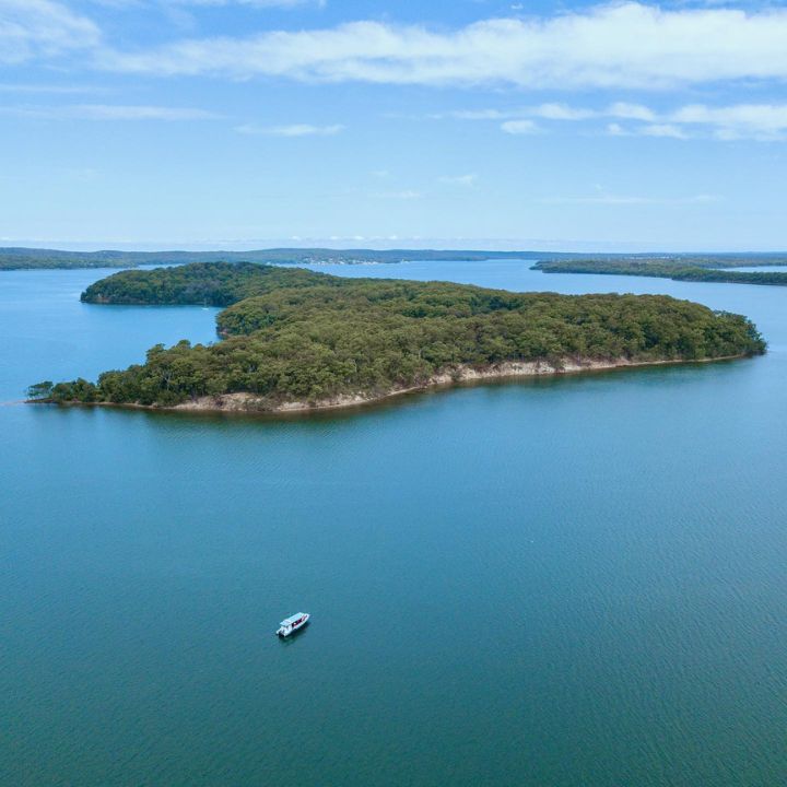
Pulbah Island
Pulbah Island located in the southern-center of Lake Macquarie is known as “Boroyiroong” in the Awabakal language. The island is believed to be home to a monster fish called “Wauwai”. Shell middens on the island are a sign of the Awabakal people’s long connection with the island. Nowadays, it is a protected Nature Reserve (which was declared in 1970) and spans 69 hectares. The island is an important refuge for lots of important native plants and animals, including koalas, wallabies, sugar gliders and a wide range of birds including white-bellied sea eagles.
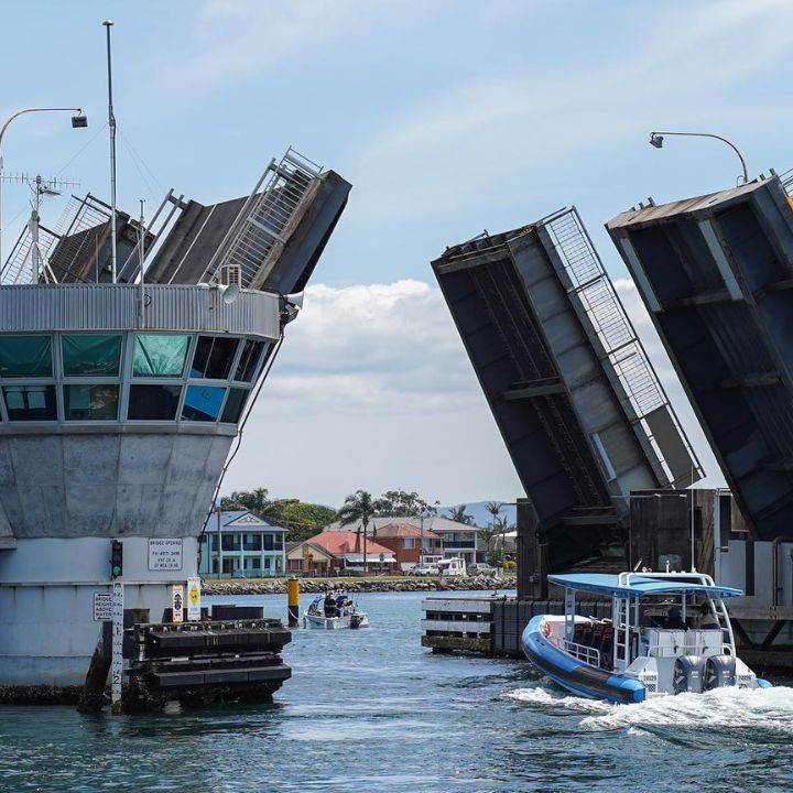
Swansea Bridge
The first bridge at Swansea was built in 1881, connecting the northern and southern sides of Lake Macquarie. Since then, there have been a few replacements – the current bridge was opened in 1989. The bridge opens to allow watercraft to pass through. Going through the open bridge on a boat gives you a unique perspective of a familiar local landmark.
Flipper the Dolphin
This friendly dolphin is a little bit of a local celebrity. While we would usually expect to see bottlenose dolphins in pods – surfing the waves at Caves Beach or even hunting for fish around Swansea Heads – this singleton is regularly seen inside Lake Macquarie, especially around Swansea. It is very inquisitive and will even approach boats and scuba divers underneath Swansea Bridge. It isn’t trapped and is free to travel to open water (should it wish to do so), but it appears to be quite happy being a “local” at the Swansea Bridge.
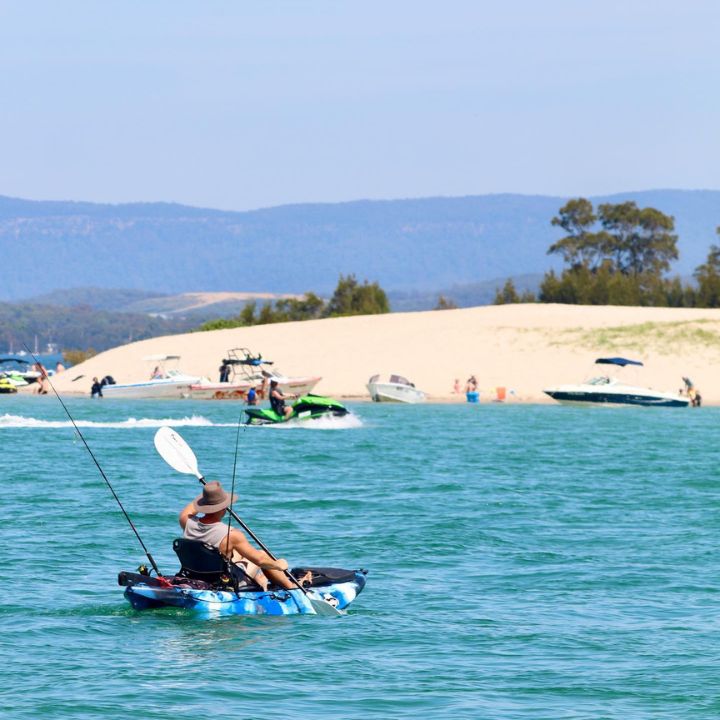
Sand Islands
Lake Macquarie is the largest coastal lake in Australia. Twice every day, a huge volume of water is pulled in and out by the tides, through the meandering Swansea Channel. The powerful tidal current washes sand back and forth, creating channels, banks and bars. Most noticeably, above the water are sand islands Elizabeth, Pelican and Spectacle. These sand islands are iconic landmarks inside Lake Macquarie itself.
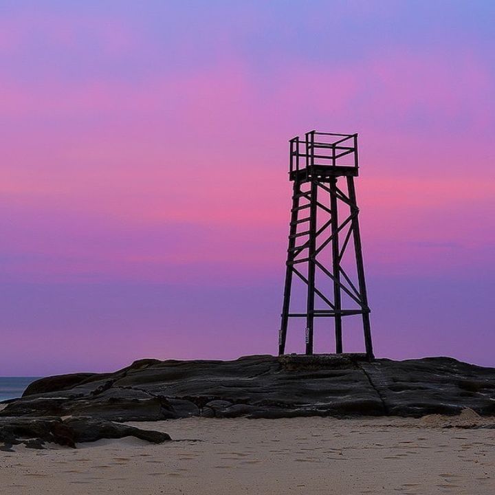
Redhead Shark Watchtower
The Redhead Shark watchtower is one of the only remaining shark towers that used to be common at NSW beaches. It was the result of a relief employment project during the Great Depression in the 1930’s. Built from recycled timber from the local coal mine, it was used as a look-out for surf lifesavers to keep beachgoers safe. Nowadays the tower has been rebuilt/maintained and is an icon of Redhead Beach. Image by @daviddiehmphotography
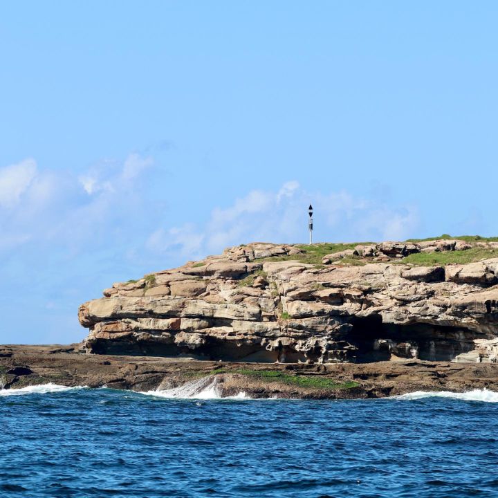
Moon Island
Do you know Moon Island? Just off the entrance to Lake Macquarie at Swansea, this little island is an important roosting site for seabirds. Sooty oystercatchers, wedge-tailed shearwaters (which used to be called mutton birds), silver gulls, kelp gulls and even a few fairy penguins have been recorded breeding there. The Awabakal name for Moon Island is “Nirritiba”, which means place of mutton birds.
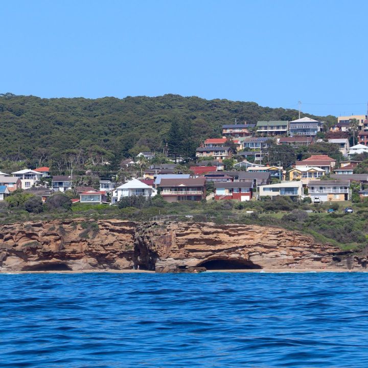
Caves Beach
If you go to Caves Beach, take a moment to appreciate the rocks. Most of the rock you see is sandstone – ancient sand that has been buried and put under extreme pressure over a very long time, until it “lithified” and turned into rock. We mean ancient – the rock that makes up the coastline at Caves Beach is approximately 255 million years old! That’s almost 200 million years before the dinosaurs went extinct! The famous caves that Caves Beach is named after are also ancient and local geologists believe these to be around 130 million years old.
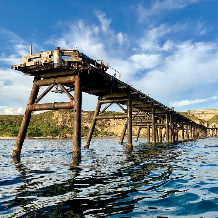
Spoon Rocks
Spoon Rocks is not a natural feature but man-made! It was built in 1981 by a mining company that planned to open a new colliery near Caves Beach and then load the coal onto ships from a structure built on the rocks. But the mine was not given government approval and the venture failed. Spoon Rocks is what is left of the foundations, a remnant of Lake Macquarie’s industrial history. From above the structure appears in the shape of a spoon, and forms spoon rocks beach which is a fantastic shallow and protected beach in most sea conditions.
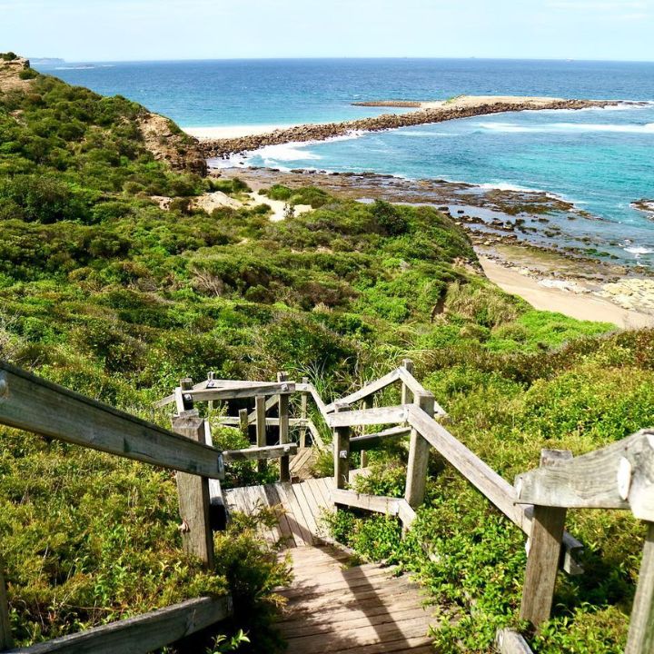
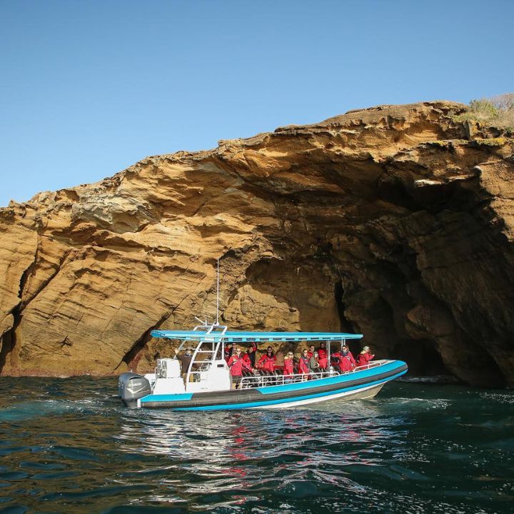
Sea Caves
Over the course of millions of years of coastal erosion, with predominantly waves and wind battering the coastline, small vertical and horizontal fractures form creating a weakness in the eroded rock. The elements continue to erode these weak sections, beginning at the base and moving upwards, causing these spectacular caves to form, and with continued erosion they’re still getting deeper!
Catherine Hill Bay and Jetty
In 1867 the ship Catherine Hill was sailing from the Richmond River in Ballina to Sydney when it ran aground during a fierce gale. The beach and bay were later named Catherine Hill Bay in commemoration of the wreck. The iconic jetty at Catherine Hill Bay (or “Catho” to locals) is a relic of the coal industry that brought wealth and development to the Lake Macquarie and Hunter region. The jetty was built in 1873 and was used to transport coal from the local mine onto ships. Approximately 1000 tons of coal a week were hauled along the jetty which operated continuously for 129 years until the closure of the local mine in 2002.